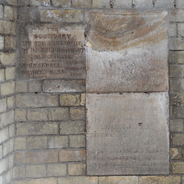
Erection date: 1868
{Top left plaque:}
The boundary of the parish of St Botolph Without Aldersgate.
John Sewell, Charles Mann – Church Wardens
1868 {or 5?}
{Top right plaque:}
{There is an arrow symbol at the very top. The rest of the inscription is lost.}
{Bottom right plaque, following an arrow symbol:}
The boundary of the parish of St Sepulchre Middlesex commences 21ft. 6in. north of this stone.
James Jackson MA - Vicar
Sam Richardson, Edwd. Gale - Church Wardens
1868
These 3 plaques are parish boundary markers. We have spent some time searching for, and poring over, maps of parish boundaries, expecting easily to find a corner where St Botolph Without Aldersgate met St Sepulchre Middlesex and one other (illegible on the plaque). That reference on one of the plaques to "21ft 6in" confirms our belief that parish boundaries tend not to change - even the disruption caused by the introduction of the Metropolitan Railway doesn't shift them.
But then we really struggled to find consistent maps; consistent with each other and consistent with these plaques. We found this Wikipedia map of 1870 and this St Sepulchre's map of 1824 both of which seem to contradict these plaques. The "19th century" map at British History On-line shows what we need: three parishes meeting - the two named on the plaques plus Liberty of Glasshouse Yard.
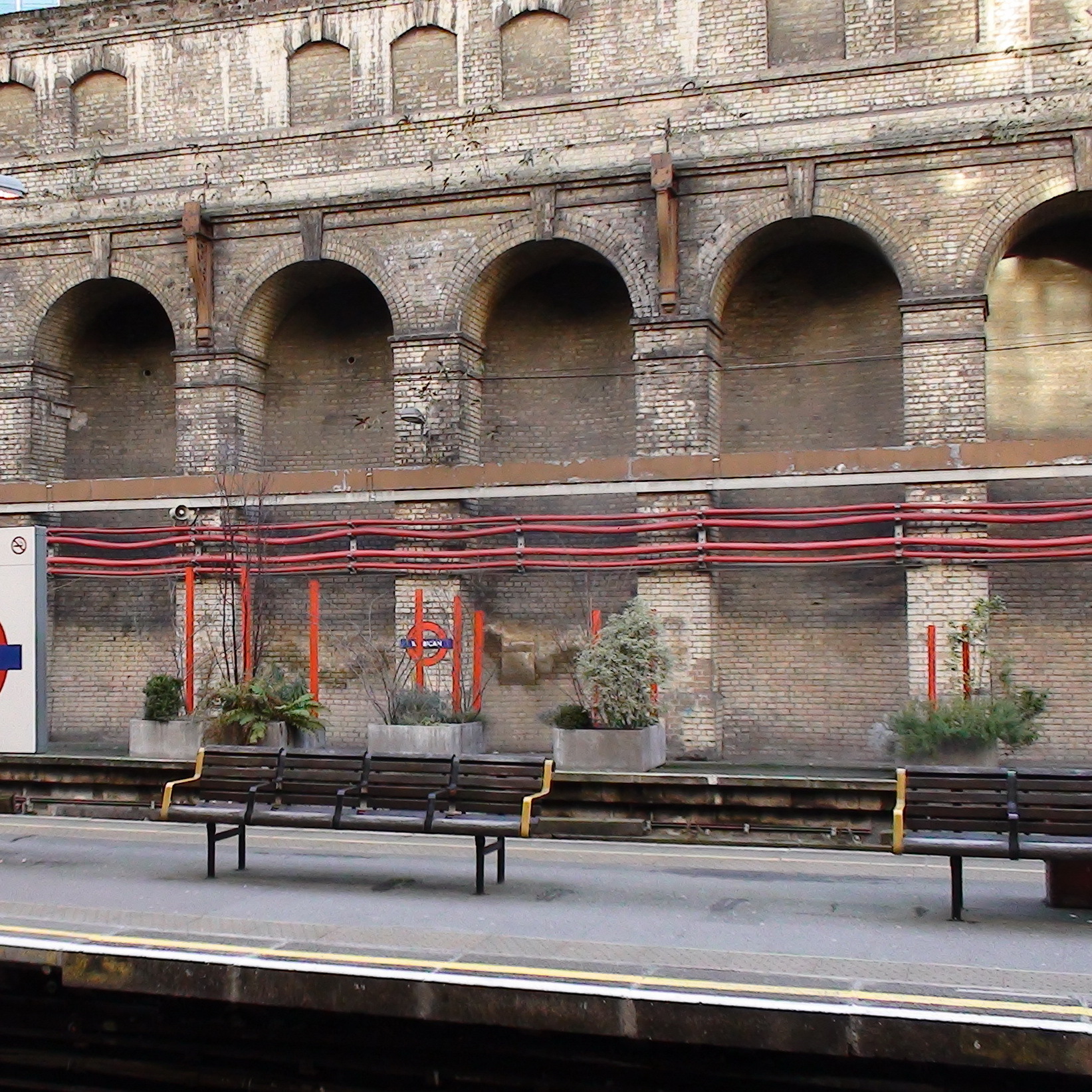
Site: Boundary markers at Barbican Station (1 memorial)
EC1, Long Lane
The eagle eyes of Londonist's Matt Brown spotted these plaques. They're at Barbican station, on the southern-most platform, which is closed and inaccessible so the 'close-up' photo is a zoom from another platform.
A history information panel at the station informs that it was opened as 'Aldersgate Street' on 23 December 1865 a date which tallies with that on the boundary stones (1865/8). We'd guess new stones were needed because the walls they used to be on were demolished during the construction of the station, and/or the introduction of the railway caused the boundaries to be moved.
Credit for this entry to: Matt Brown


Comments are provided by Facebook, please ensure you are signed in here to see them